
Long-term kit
RL116 long-term radon test kit
- Lab fee extra
Method: Alpha track
In home: 90 days to 12 months
Locations and reports
EPA puts Mills County in Zone 1, its highest radon zone, and high results are common there: 70.1% of the 465 radon tests reported to CDC (2008 to 2017, laboratory totals) came back at or above 4 pCi/L. Homes with elevated levels occur in all three zones, so only a test measures yours.
Data checked By Radon411Methodology
Share at 4+ pCi/L
70.1%
11.6 pts above IA
465 tests, 2008 to 2017
Median result
6.1pCi/L
Action level reached
Midpoint of the tests, 2008 to 2017
Tests reported
465
51st of 99 by tests
Reported to CDC before any fix, 2008 to 2017
EPA radon zone
Zone 1
Highest potential
1 highest, 3 lowest
EPA predicts over 4 pCi/L indoors
Rank in Iowa
31 of 99
Middle half
By share, of 99 with 30+ tests
Read a result for Mills County
EPA’s own thresholds; the figures are the area’s, never this home’s.
EPA’s reading of 6.1 pCi/L
At or above 4 pCi/L
This result is at or above 4 pCi/L. EPA recommends fixing a home when the radon level is 4 pCi/L or higher. Mills County's median reported result, 2008 to 2017.
The data
Mills County, At a glance
Predicted: EPA radon zone
EPA puts all of Mills County in
USGS geologic potential: High across 100% of the county's area
Predicted: EPA Map of Radon Zones
Measured: tests reported to CDC
Of 465 pre-mitigation tests reported to CDC, not homes in this area.
| Result band | Tests Measured | Share Measured |
|---|---|---|
| Under 2 pCi/L | 55 | 11.8% |
| 2 to 4 pCi/L | 84 | 18.1% |
| 4 pCi/L and above | 326 | 70.1% |
These are the 465 tests reported to CDC for Mills County over 2008 to 2017 (laboratory totals), many from homes being sold or already suspected of a problem: they describe the county's reported tests, not this house.
Measured: CDC tracking data. Figure above: 2008 to 2017, laboratory. Measured data period: 2005 to 2017 (every CDC figure on file).
Mills County, Compared
More than half: 70.1% of the 465 radon tests reported to CDC for Mills County over the 2008 to 2017 laboratory totals read at least 4 pCi/L. That places it 31st of 99 Iowa counties with 30 or more tests for the same period. That is 11.6 points above the 58.5% pooled from 99 Iowa counties.
The median result, 6.1 pCi/L, sits above EPA's 4 pCi/L action level, and the top reported result was 53.2 pCi/L. The rest split 11.8% under 2 pCi/L and 18.1% from 2 to 4 (Iowa: 21.8% and 19.7%). Zone 1 on EPA's map (predicted average above 4 pCi/L) and a 70.1% share point the same way here.
1 of its 6 bordering counties with figures ran higher, led by Page County at 71.7%; Sarpy County, NE reported 53.6%. Statewide for the same period, Sioux County reported the highest share (84.2%) and Decatur County the lowest (25.9%).
CDC's ten-year totals for Mills County went from 319 tests (2005 to 2014) to 465 (2008 to 2017), the share going from 75.2% to 70.1%.
Nationally, every county with a figure for the same period pools to 35.7%; Mills County sits 34.4 points above it. CDC also counts 64 tests taken after mitigation in Mills County for the same period: tests in homes where a fix was already in.
Pooled shares: Radon411's sum of CDC's county counts for one period.
Mills County, Geology
USGS's geologic map puts all of Mills County's mapped land in one class: high radon potential. All of it lies in the area the map calls Loess-Covered Drift Plains, to which USGS gives a radon index of 13, in the high band (12 to 17).
| Area | The rock, in USGS's words | Potential | Radon index | Share of land |
|---|---|---|---|---|
| Loess-Covered Drift Plains | Pre-Illinoian and Illinoian glacial deposits, and loess. | High | 13 | 99.6% |
Names, descriptions and indexes: U.S. Geological Survey, Geologic Radon Potential Map (2025). Shares: Radon411, from the map cut to the boundary.
On high-potential ground Mills County is close to Iowa as a whole: 100% of its land against 98.8%. Of the 6 counties that border it, none has as large a share of high-potential ground; Cass County, NE comes nearest at 100%.
The map rates the ground, not the air in any home.
Local help
Mills County, Local resources
You can reach the Hotline by calling 1-800-383-5992 to order low-cost radon test kits and find answers to your radon questions.
Iowa’s radon program approves applications for persons who wish to become certified to perform radon testing or credentialed to perform mitigation and laboratories that provide radon testing devices and analytical services.
However, per Iowa Code chapters 543B.9 and 543B.18 and Iowa Administrative Code 193E Chapter 14 administered by the Iowa Real Estate Commission, a seller must disclose any known tests for the presence of radon and if yes, provide the date of last report and the result(s).
What it means
Mills County, Questions
Over the 2008 to 2017 laboratory totals, 70.1% of the radon tests reported to CDC for Mills County, Iowa were at or above 4 pCi/L, and the median reported pre-mitigation result was 6.1 pCi/L. Of 99 Iowa counties with 30 or more tests for the same period, 30 reported a higher share; pooled, the state comes to 58.5%.
Mills County borders 6 counties: Fremont County, IA, Pottawattamie County, IA, Montgomery County, IA, Sarpy County, NE, Cass County, NE and Page County, IA.
Products
Mills County, Products
In Mills County, 70.1% of 465 tests reported to CDC over the 2008 to 2017 laboratory totals reached 4 pCi/L, against 58.5% pooled across Iowa. In Zone 1 the year-round level in Mills County is the one to know: a long-term test (more than 90 days) or a monitor, with a short-term kit for a first answer.
Long-term kit
Method: Alpha track
In home: 90 days to 12 months
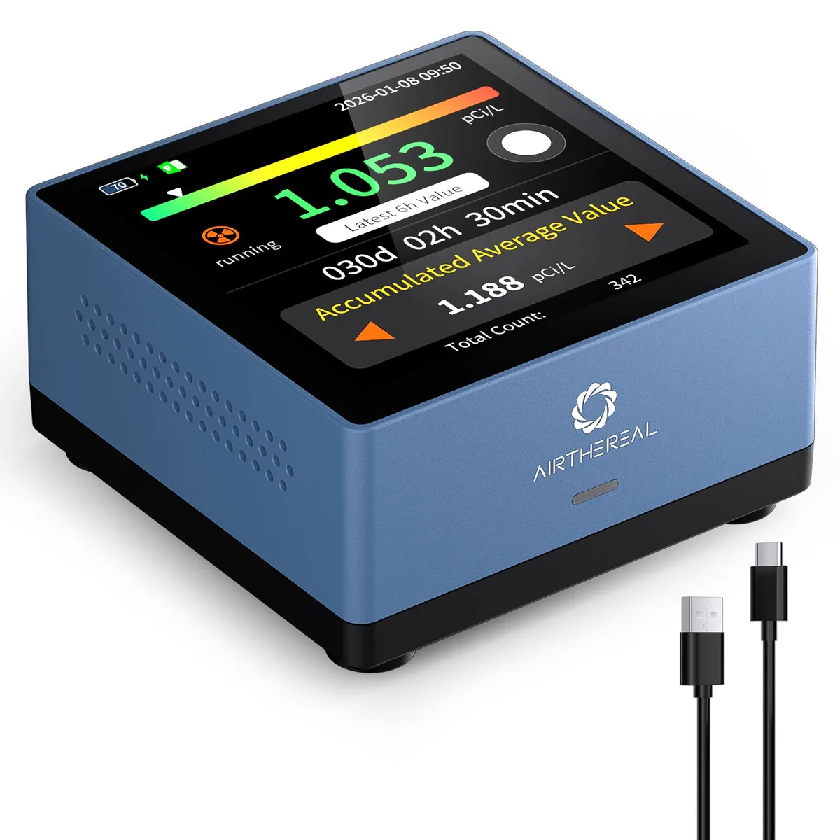
Monitor
Method: Semiconductor sensor
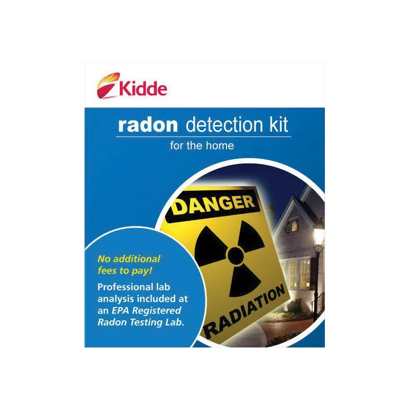
Short-term kitKidde
Method: Charcoal
In home: 3 days
Test kits and monitors: 1 of 3
Mills County is in EPA Zone 1, the highest predicted radon potential. Best radon monitors for Zone 1 counties like Mills County
Explore
Mills County, Bordering counties
71.7%at or above 4 pCi/L
Median 7.2 pCi/L · 653 tests · 1.6 points above Mills County
69.8%at or above 4 pCi/L
Median 7.2 pCi/L · 205 tests · 0.3 points below Mills County
67.4%at or above 4 pCi/L
Median 6.1 pCi/L · 233 tests · 2.7 points below Mills County
66.0%at or above 4 pCi/L
Median 6.3 pCi/L · 620 tests · 4.1 points below Mills County
57.4%at or above 4 pCi/L
Median 4.7 pCi/L · 1,868 tests · 12.7 points below Mills County
53.6%at or above 4 pCi/L
Median 4.3 pCi/L · 4,799 tests · 16.5 points below Mills County
Mills County, Cities and towns
The Census Bureau estimates 14,793 residents in Mills County for July 1, 2025, 380 more than in 2020 (+2.6%). That works out to 34 people per square mile of land. Its largest town, Glenwood, has 5,287 residents, 35.7% of the total. CDC's 465 reported tests for 2008 to 2017 work out to 31.4 per 1,000 residents (2025 estimate), close to Iowa's 29.4.
From Glenwood to Pacific Junction, CDC publishes no figure by town: each reads Mills County's.
| Place | Residents | Since 2020 | Share of residents |
|---|---|---|---|
| Glenwood | 5,287 | +4.4% | 35.7% |
| Malvern | 1,073 | +4.1% | 7.3% |
| Taborextends beyond Mills County | 985 | −2.2% | Counted whole |
| Emerson | 400 | +0.5% | 2.7% |
| Silver City | 246 | +2.5% | 1.7% |
| Hastings | 158 | +2.6% | 1.1% |
| Henderson | 137 | Level | 0.9% |
| Pacific Junction | 100 | +1.0% | 0.7% |
8 incorporated places, as listed in the U.S. Census Bureau’s 2020 place reference files. Residents: U.S. Census Bureau population estimates for July 1, 2025 (Vintage 2025). A place that extends beyond Mills County is counted whole, so it has no share.
Mills County, Homes
Mills County is a place of houses on their own lots: 84% of its 6,119 homes are detached single-family houses, against 72% across Iowa. Half of its homes were built before 1973, close to Iowa's 1971: 35% date from before 1960 and 18% from 2000 or later. Owners live in 84% of the occupied homes (Iowa: 72%), so for most households a test and a fix are their own to order.
| Homes | Mills County | Iowa |
|---|---|---|
| Housing units | 6,119 | 1,427,175 |
| Detached houses | 84% | 72% |
| In buildings of 5 or more | 3% | 14% |
| Mobile homes | 3% | 3% |
| Built before 1960 | 35% | 39% |
| Built since 2000 | 18% | 21% |
| Middle year built | 1973 | 1971 |
| Owner-occupied | 84% | 72% |
Census Bureau, American Community Survey, 2019 to 2023: estimates from a sample of homes, looser for a small place. Shares by Radon411.